Interactive Map of Climate Risks in Brazil
Climate Risks These are a growing concern worldwide, especially in Brazil, where the consequences of global warming are becoming increasingly evident.
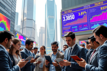
In this article, we will explore the "Brazil in a World +2°C" platform, which offers a free interactive map to help companies and governments identify and assess these risks.
Using 11 climate models and satellite data, the tool allows for an in-depth analysis of the impacts on highways, urban areas, and agriculture.
Let's discuss how this initiative can facilitate informed decisions and promote collaborative management of the climate challenges we face.
Interactive Map: Overview and Relevance
The free interactive map "Brazil in a World +2°C" is an innovative tool designed to help companies and governments identify climate risks on highways, in urban areas, and in agriculture.
With increasing concerns related to global warming, the platform becomes essential for supporting strategic decisions aimed at mitigating climate impacts.
Available free of charge, the map promotes awareness and collaboration between different sectors, which is essential to addressing the challenges posed by climate change.
Context of Global Warming and the Need for Digital Tools
Global warming +2°C This represents a significant challenge, especially for Brazil, a country with vast areas vulnerable to natural disasters.
With the advancement of climate change, extreme phenomena such as floods and droughts will become more frequent and intense.
This temperature increase may affect critical infrastructure and food security, causing direct and indirect impacts on millions of Brazilians.
Therefore, the use of digital tools, such as Interactive Map of Brazil in a World +2°CThis is crucial for the proactive management of climate risks.
These innovative technologies, which utilize satellite data and advanced climate models, allow governments and businesses to identify vulnerable areas and make informed decisions about investments in resilient infrastructure.
Integrate this data into the formulation of public policies. It ensures that adaptation measures are effective in minimizing climate impacts, promoting more sustainable and safer development for communities.
Scientific Basis and Methodologies
The scientific basis and methodologies used in Brazil in a world warming +2°C are essential to ensure the accuracy of climate risk forecasts.
The combination of 11 distinct climate models, along with satellite data, allows for a robust analysis of atmospheric and terrestrial conditions, enabling the identification of floods, droughts, and other hazards that can impact infrastructure and agricultural production.
This integrated approach is fundamental to providing reliable information that assists in making informed decisions about investments and necessary adaptations.
Integration of 11 Climate Models and Satellite Data
Integrating the 11 climate models with satellite data is crucial for projecting global warming scenarios of +2°C in Brazil.
Each model undergoes a rigorous calibration process to ensure that the predictions are accurate and reliable.
These calibration processes They adjust the model parameters to reflect specific and local weather conditions.
To validate these projections, we extensively used satellite observations that provide accurate data on critical climate variables, such as temperature and precipitation.
This allows the models to adjust their predictions and achieve greater accuracy.
Continuous verification and updating of data are essential, highlighting the importance of rigorous quality control.
Thus, the projections resulting from these climate models become a valuable resource for identifying and managing climate risks in Brazil. becoming a pillar for informed decisions.
Priority Sectors at Risk from Climate Change
Critical sectors in Brazil face increasing risks due to climate change, as evidenced by the interactive map "Brazil in a 2°C+ World".
The platform highlights vulnerabilities in infrastructure, agriculture, and urban areas, showing the importance of anticipating potential damage and taking preventative measures.
Promoting natural mitigation solutions is presented as an essential strategy to face these challenges and ensure a more resilient future.
Convergence of Threats and Nature-Based Solutions
The interactive map Brazil in a World +2°C highlights overlapping areas of climate risks, allowing governments and companies to identify where nature-based interventions They offer significant benefits.
By analyzing where highways, urban areas, and agriculture face combined threats, it becomes possible to plan. mitigation measures.
The restoration of mangroves, for example, protects coastal areas against flooding and erosion.
Green corridors They reduce urban heat islands, improving quality of life and resilience to extreme weather events.
These solutions
based on nature
encourage investments in green infrastructure, promoting the sustainability and mitigating the effects of climate change.
Strategic Investment and Adaptation Decisions
The platform Brazil in a World +2°C It plays an essential role in guiding strategic investments and formulating strategies for adapting to climate change.
Using accurate satellite data Using advanced climate models, the tool allows companies and governments to visualize areas vulnerable to climate risks such as floods and droughts.
With this information, decision-makers can prioritize investments in resilient infrastructure, such as highways and urban drainage systems, mitigating future disastrous impacts.
Furthermore, It is crucial. that agricultural producers access the map to adjust their agricultural insurance plans, considering global warming scenarios.
Urban planning, in turn, benefits. immensely of this information, guiding the development of more sustainable cities capable of withstanding extreme weather events.
Promoting awareness and collaboration is vital to ensure that these measures are implemented before climate impacts intensify, as recommended by various government agencies in their reports on the importance of preventive action.
Platform as a Catalyst for Awareness and Collaboration
The platform "Brazil in a World +2°C", accessible at www.brasil2c.com, acts as a vital bridge between businesses, governments and society, promoting a effective multi-sectoral collaboration in climate risk management.
With precise data obtained from 11 climate and satellite models, the tool not only highlights the potential impacts of a global warming scenario on urban areas, highways, and agriculture, but also enables informed decisions to be made about necessary investments and adaptations.
Thus, each sector is called upon to play a crucial role in mitigating environmental risks.
Furthermore, the platform highlights how nature can help in mitigation, creating a cycle of learning and adaptation.
By interacting with the platform, users are encouraged to adopt more sustainable practices and take collective responsibility for the necessary changes.
Through this initiative, engagement is transformed into concrete action., strengthening a culture of adaptation and resilience in Brazil.
In summary, the "Brazil in a World +2°C" platform is an essential tool for identifying and mitigating climate risks.
By promoting awareness and collaboration, it stands out as a valuable resource for protecting our infrastructure and the environment.


0 Comments